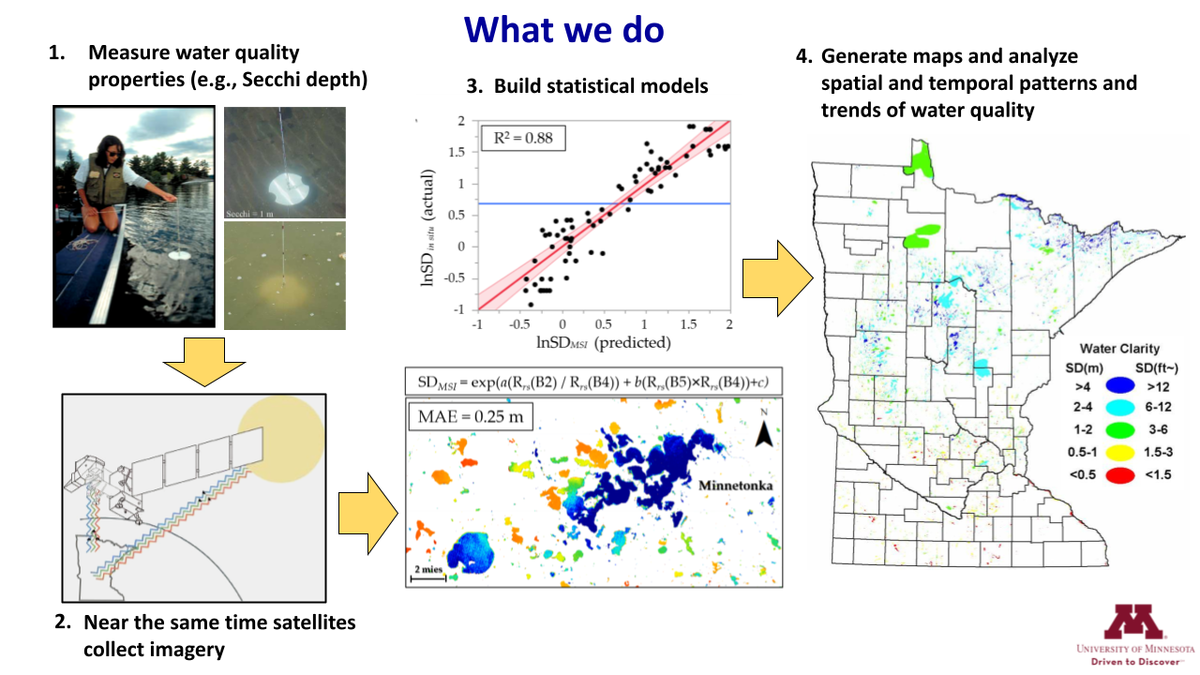
Our group conducts research in three primary areas. First, we develop and improve methods to retrieve information on key water quality measures from satellite imagery. Our approaches for doing this are described on the methods pages of this website. The methods development research typically involves the collection of ground-based data for image calibration and model validation.
Second, we apply these methods to retrieve data on water quality measures, including water clarity, chlorophyll, CDOM as a measure of natural organic matter, and suspended matter, across Minnesota and neighboring regions and states, providing spatial and temporal information that is unattainable by ground-based methods.
Third, we analyze the data from satellite imagery for spatial patterns and temporal trends and for relationships with watersheds and other lake and land conditions to improve our understanding of the natural and human-related factors affecting surface water quality in the region. Examples of results for the latter two research areas are found in the metrics of surface water quality pages.
The publications page lists journal articles and technical presentations describing our results in each of these areas and has a link to a brochure summarizing satellite remote sensing for monitoring surface water quality.